Maps and Their Stories
Interestingly in the Upper Clutha History Society’s collection, is a series of maps retrieved in 2016 from Wānaka Wastebusters - “one man’s trash becomes another man’s treasure” - incorporating the Upper Clutha Region from Cardrona, the Lower Lake Wānaka and Hāwea Survey Districts to Tarras, including Luggate and Albert Town. The series was requisitioned by the Ministry of Works from the Department of Lands and Survey courtesy of the Surveyor General, to be used as Working Plans by the Electricity Department, for the purpose of Waterpower Development in the Upper Clutha.
This is a compelling if not frightening story. In the late 1950’s a large high dam was proposed at Lowburn effectively flooding the Upper Clutha, including rich farmland around Tarras and other areas below Mt Burke, West Wānaka, Makarora, and including Lower Helwick St and Pembroke Park. Until recently, high on Sugar Loaf above the Lowburn dog trial course, a row of stones marked the height of the proposed dam. Under the Land Act 1948 the Department, to avoid any large compensation claims in the future, took the precaution of acquiring 26 acres in the middle of the town of Wānaka (part of Pembroke Park). Breathing space was gained however by the completion in 1958 of the Lake Hāwea control scheme, thus securing water storage for the Roxburgh dam.
Politics then became an issue. The National Party’s Murray Rose was non-committal about Lake Wānaka’s future, while Labour’s Ian Quigley, gave an assurance that if it became Government, they would introduce the Wānaka Preservation Act. On 2 June 1973, the local citizens formed a group called Hands off Lake Wanaka (HOWL) as a pressure group. In November 1973, the Kirk Government passed the Lake Wānaka Preservation Act, and saw the appointment of a Guardians of Lake Wanaka Committee whose important task was to guard against any proposal that would interfere with the lake’s natural levels. A similar committee was set up in 1979 for Lake Hāwea, whose task was to monitor and set minimum lake levels. Further reading on these matters can be obtained in Paul Power’s book – Who Killed the Clutha?
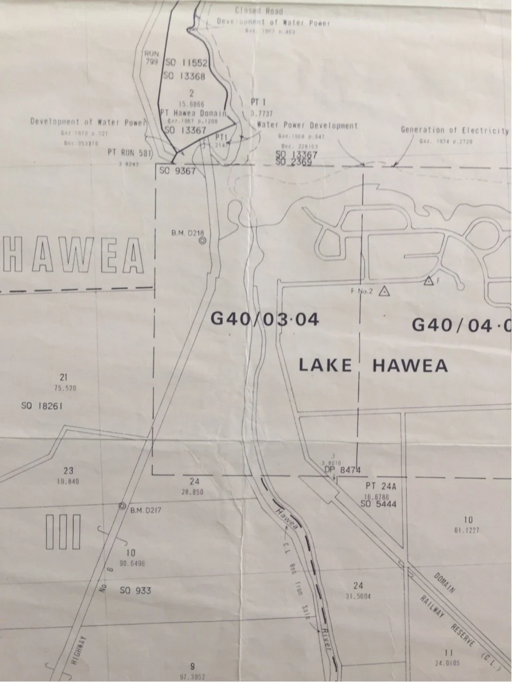
The map segment on the next page of the Lake Hāwea outlet area shows that -
Significant areas along the edges of the Clutha, Hāwea and the Cardrona rivers were designated Crown Land and reserved from sale.
Gold mining plans for the entire Upper Clutha and Cardrona Valleys are noted.
Much of the Lake Wānaka foreshore became known as ‘The Wanaka Islands Domain’, was available exclusively for public use, and reserved from sale.
The map also highlights expected areas of inundation caused by raising the level of the Lake Hāwea to varying heights (including the dates when they were first gazetted), from the maximum height - indicated by a solid line to the original lake level - represented by a line of dashes.
A railway reserve running beside Domain Rd towards Hāwea Flat, would indicate that at the time of publishing (1976), the concept of a railway from Cromwell was still being entertained.
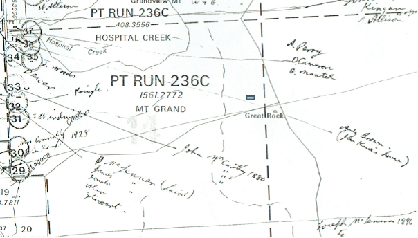
Stan Kane’s Map Annotations
The Society contains in its map collection, a series of Survey or Cadastral Maps (NZMS 261) of the Upper Clutha region, which depict the location and sometimes ownership sequence for many Sections or Blocks dating back, in some instances, to the 19th century and up to approximately 1995. Included is interesting historical information such as the positioning of homesteads, cottages, boarding establishments for both rural and some urban (plus in some instances building materials used), old school and hotel sites. Notes on land use i.e., goldmining, timber, and flax milling, are sometimes included.
This work was painstakingly researched and annotated by Stan Kane, a long-term resident of the Upper Clutha (born 1917). His grandfather, John Kane, came to the Upper Clutha about 1868, and eventually became the owner of Grandview in 1890. Grandview remains in the ownership of direct descendants. It should also be noted that Stan was the inaugural President of the Society that was formed in 1985. He spent many hours researching and recording Upper Clutha history and annotating the maps we have.
For research purposes, please note that these maps have been fully indexed and accessioned in the Upper Clutha History Society’s data base.
Two examples of Stan’s work, “cut” from two maps, follow (they are easier to read on the full-size map!):
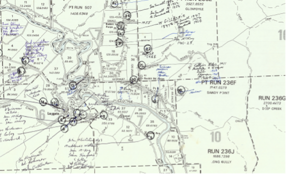
This shows the area around Luggate.