Early Runs and Farms in the Upper Clutha
Introduction:
The following information was researched and collated by Ken Thomlinson (UCHS), from various records, including the Runs Register held at Archives New Zealand in Dunedin.
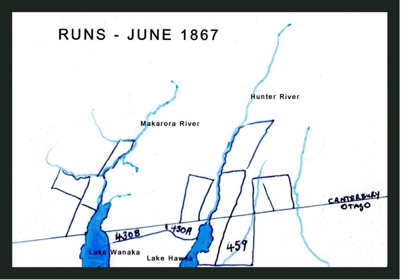
Provincial boundaries between Canterbury and Otago were interpreted differently by each Council for several years until this was finally resolved in 1899. For the Upper Clutha region this affected the Mt Albert, Makarora, Hunter Valley, Mt Jones and Dingleburn Stations.
Glossary:
Station
Originally referred to the homestead and the immediate surrounding area, then later as a large farm or property.
Run
Another word for Station but formerly meaning the land that went with a Station.
Run Numbers
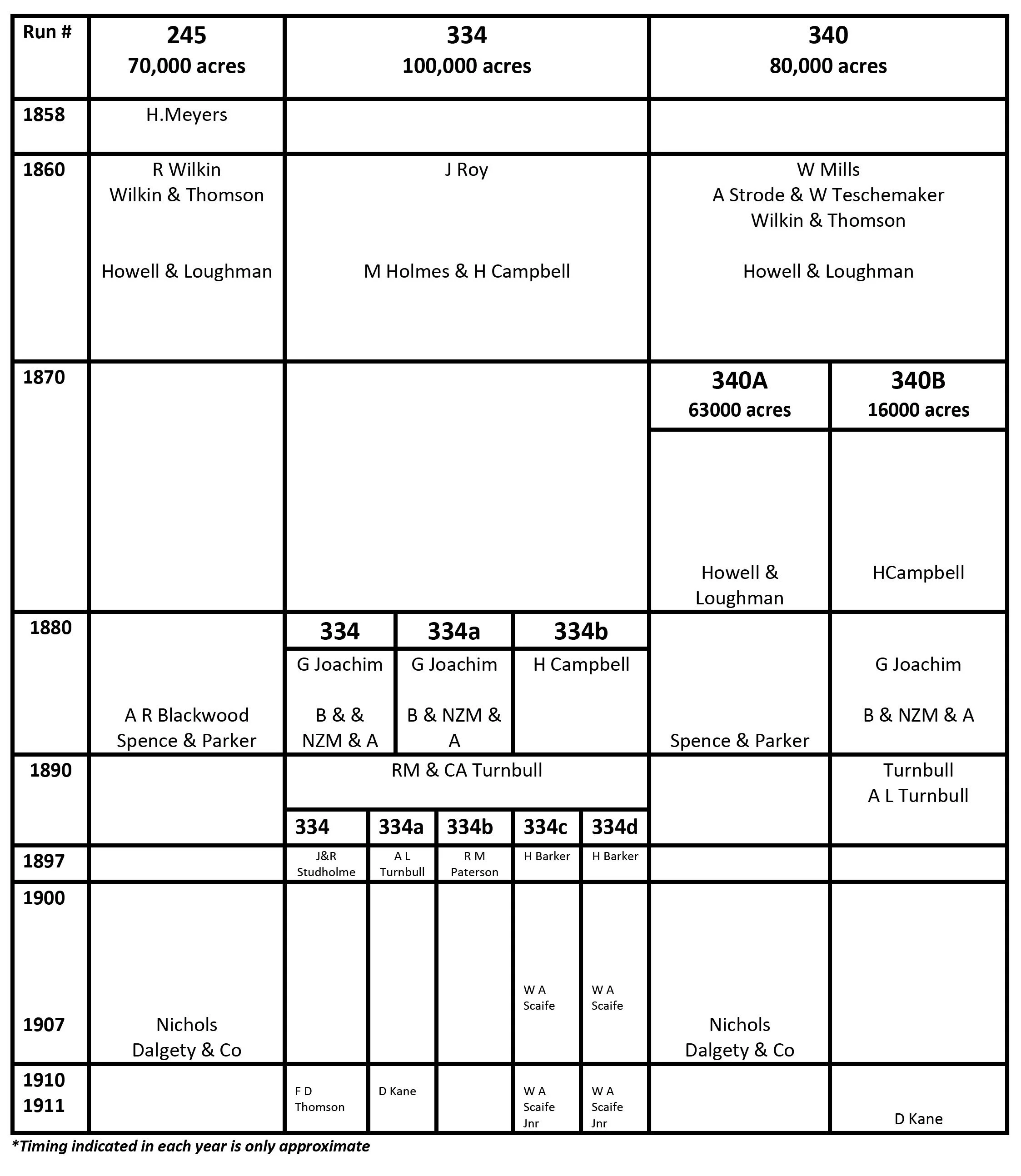
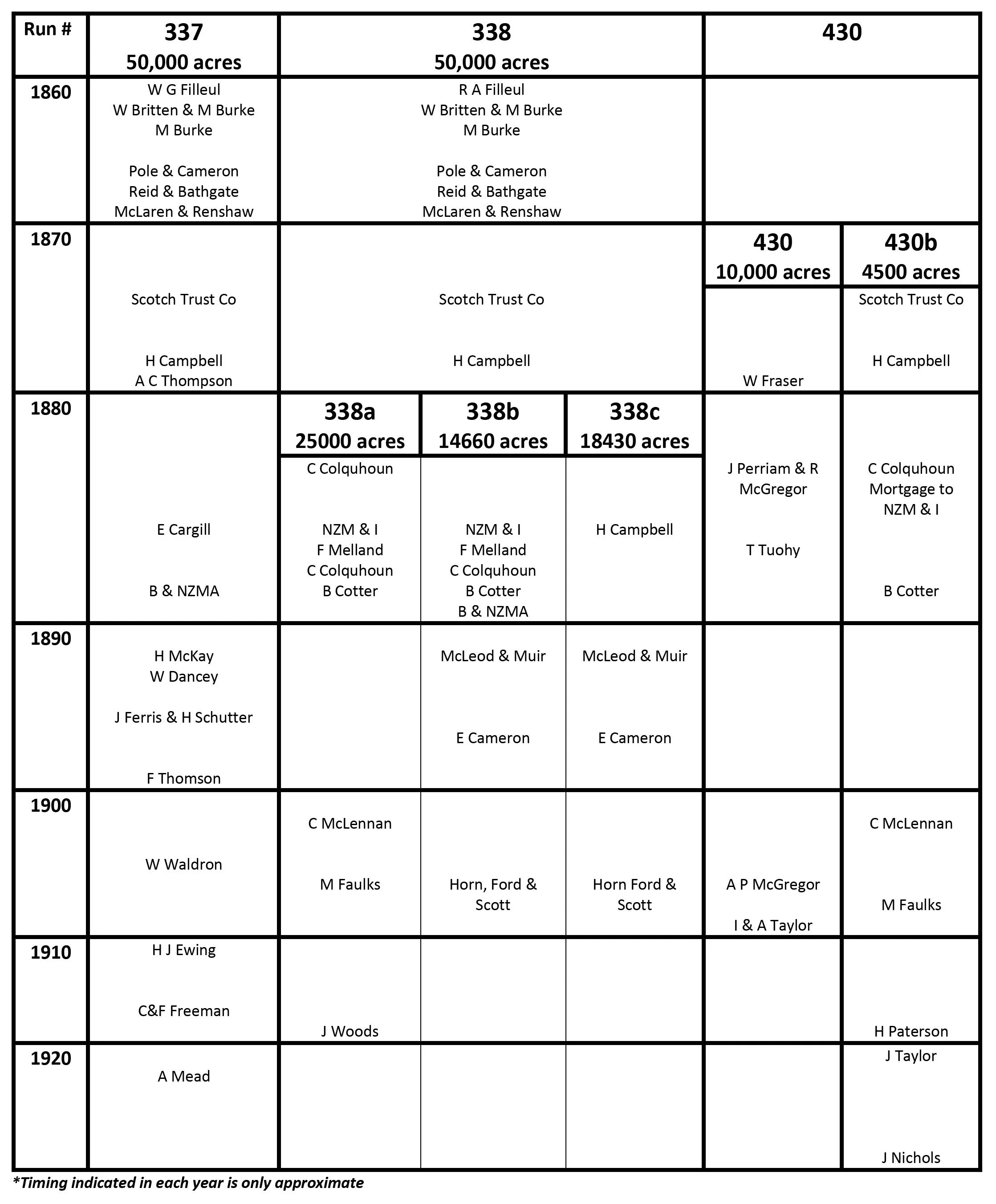
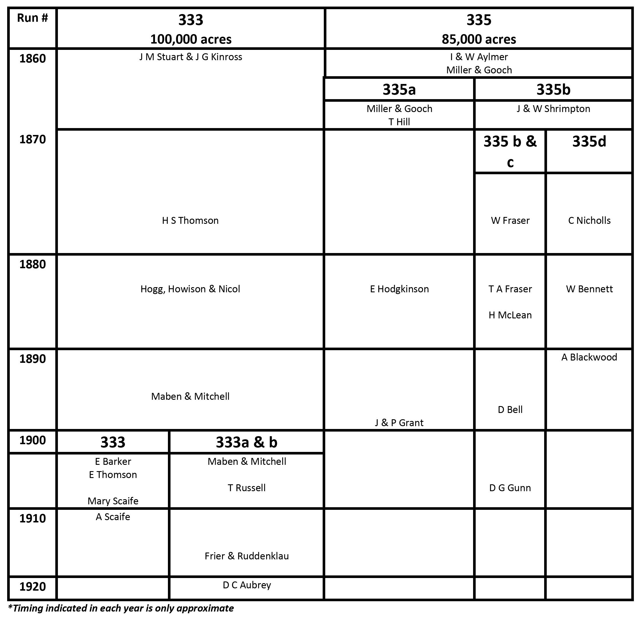
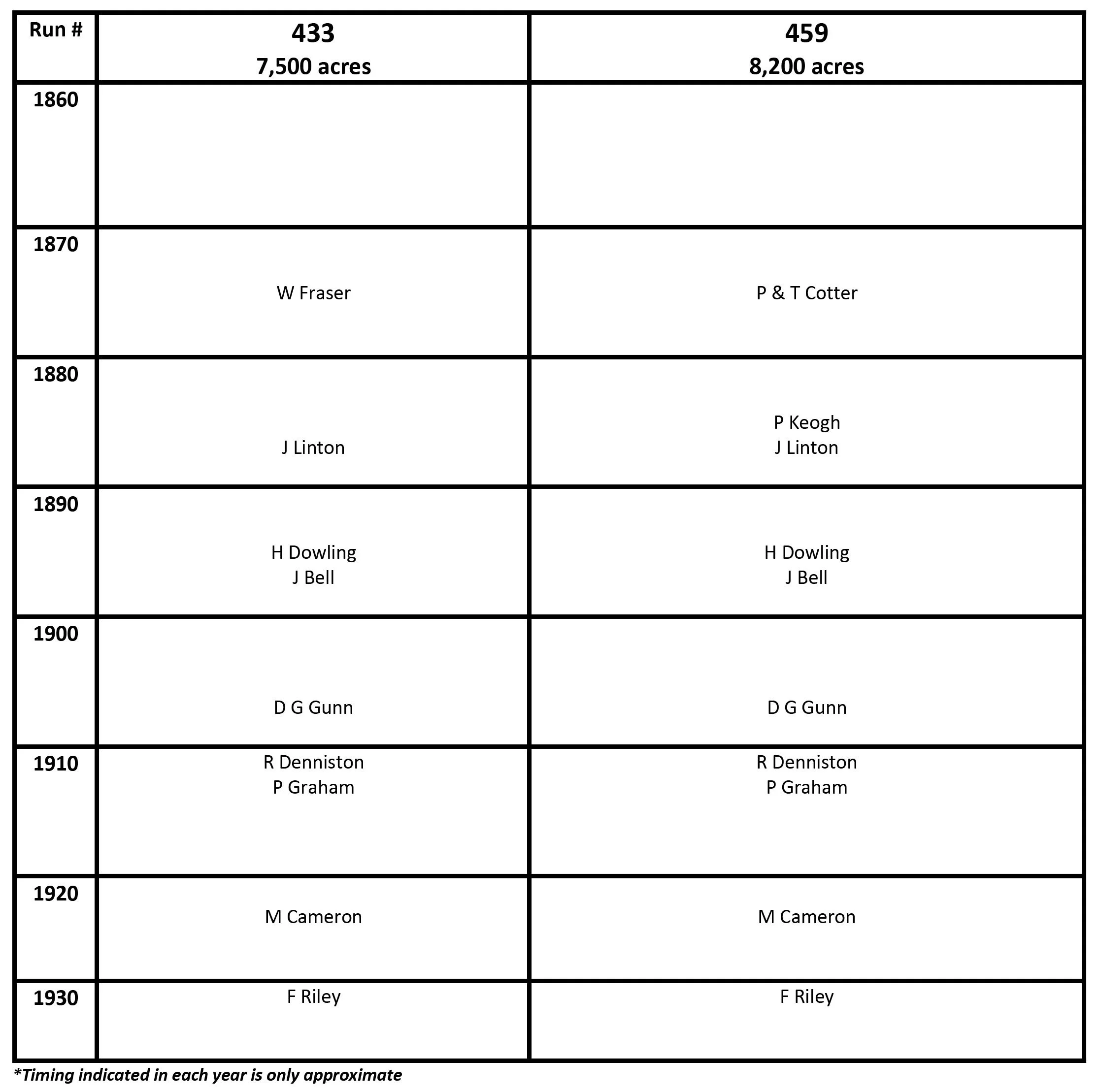
They were allocated to each licence and later, when subdivided, often given a letter to indicate a portion of the original number.
Depasturing Licence
Later became known as Pastoral Licence which were allocated to a set portion of land or run for a set period of time (often 14 years).
B & NZM & A
British and New Zealand Mortgage and Agency
NZM & I
New Zealand Mortgage and Investment Association Ltd
Dalgety & Co
A stock and station agency
Station Names in the Upper Clutha:
Lake Hāwea
Now borders in the north by Dingleburn, in the east 236B Forest Range Station and 235A Breast Hill Station, in the south by Mount Grand Station.
Dingleburn
Renamed as such in 1954 after the raising of Lake Hāwea with the amalgamation of Timaru Creek Run, Mt Jones Run and the eastern side of Hunter Valley Station.
Ben Wyvis (Benweis)
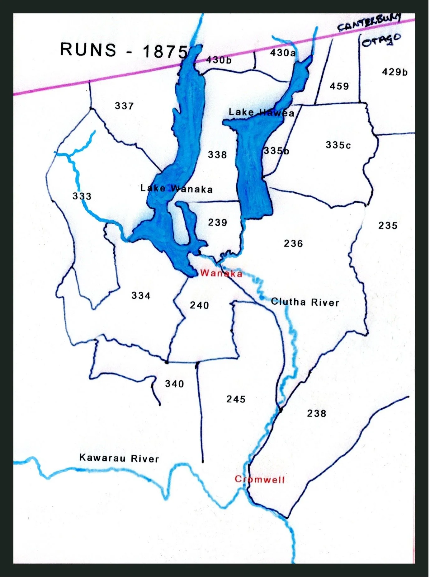
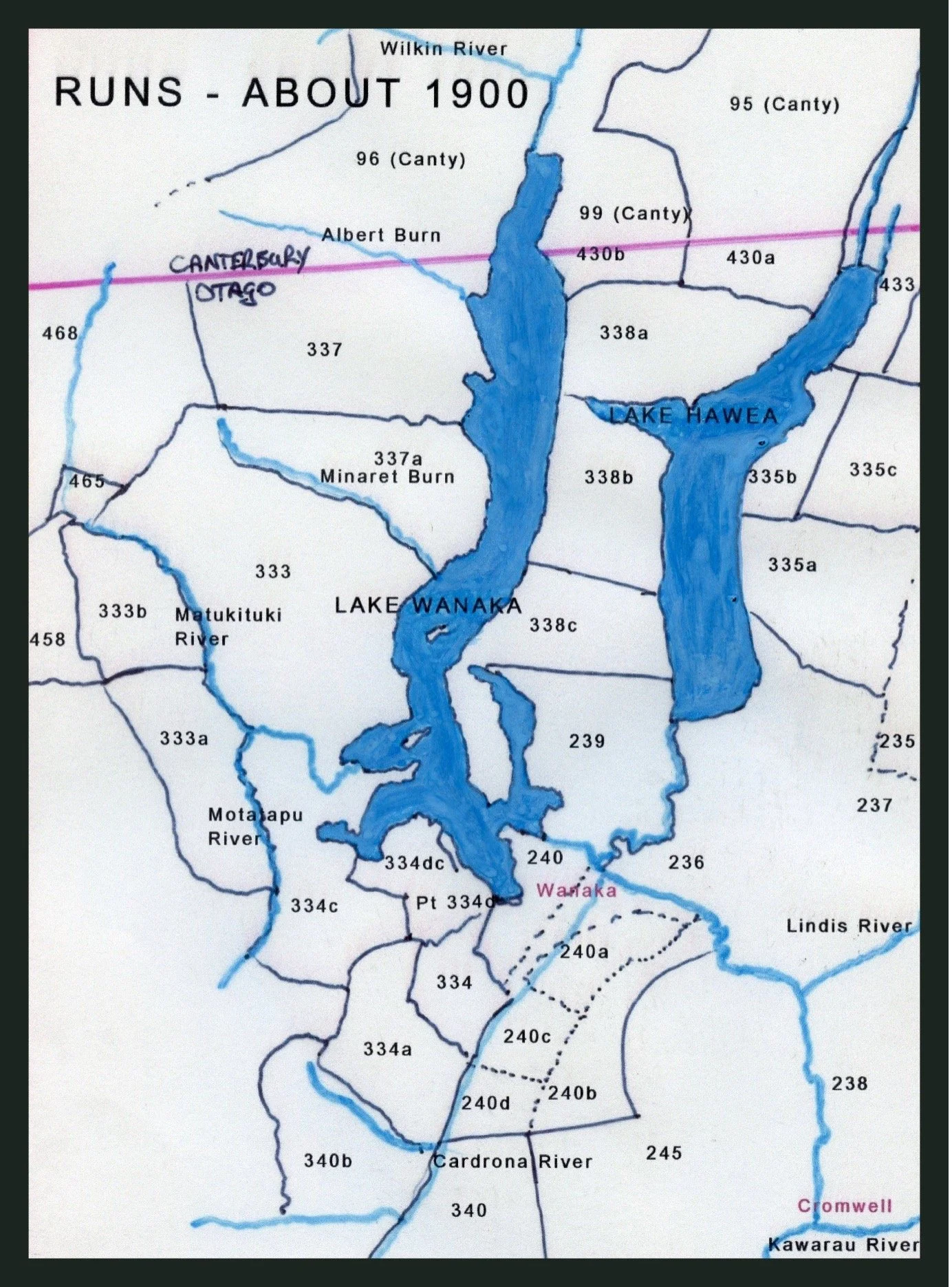
Run 338A on mid-western shores of Lake Hāwea. It became amalgamated in 1954 into the Hunter Valley Station.
Hunter Valley
At the head of Lake Hāwea
Makarora
Situated in the Makarora Valley. It was split up in 1995 with a portion being renamed Makarora River Ranch.
Mt Albert
Situated in the west Makarora Valley at the head of Lake Wānaka.
Minaret
Runs 337 and 337A bordered by the Alphaburn River in the north, Lake Wānaka to the east, Minaret Burn to the south and unclaimed Crown land to the west stretching to the Tasman Sea.
Glendhu
Runs 334C and 334D.
Alphaburn
Originally part of Glendhu and includes Roys Peak.
West Wānaka
Run 333 was subdivided in 1901.
Cattle Flat
Originally part of West Wānaka until 1901.
Matukituki
Established in 1983 when subdivided off Cattle Flat. It lies to the northern end of the Matukituki Valley, bordering Mt Aspiring Station at Niger Creek.
Mt Aspiring Station
Named as such in 1920.
Glencoe
Part of Ayreburn Station. Goes from the Arrow River into the Cardrona.
Motatapu
Was the back block of Glencoe Station until 1947. Most of the Motatapu Valley was, for some years, part of the very large Wanaka Station.
Mt Burke
Formerly known as Forks Run, it is situated between the two lakes, Hāwea on the east and Wānaka on the west. It includes the Peninsula, the four peaks - Isthmus, Mt. Burke, Mt. Gold and Mt. Maude.
Glen Dene
Originally part of Mt. Burke, it was established in 1979. It borders Lake Hāwea on the east, Lake Wānaka on the west, The Neck in the north and Mt. Maude and the Hāwea Motor Camp in the south.
Lake McKay
Currently an amalgamation of McKay on the Pisa Range and Midrun properties in 1990.
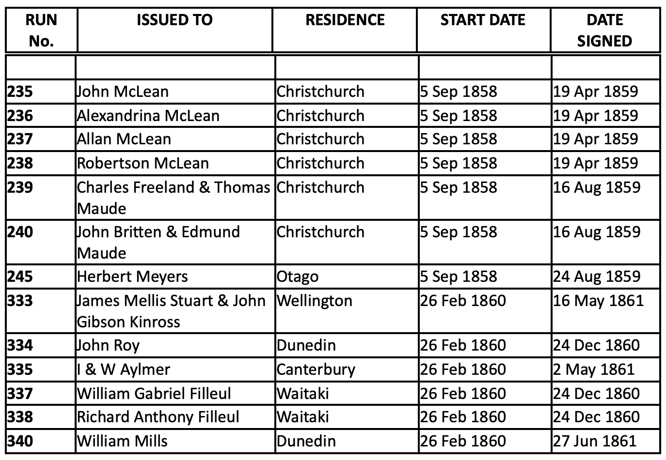
The First Depasturing Licences
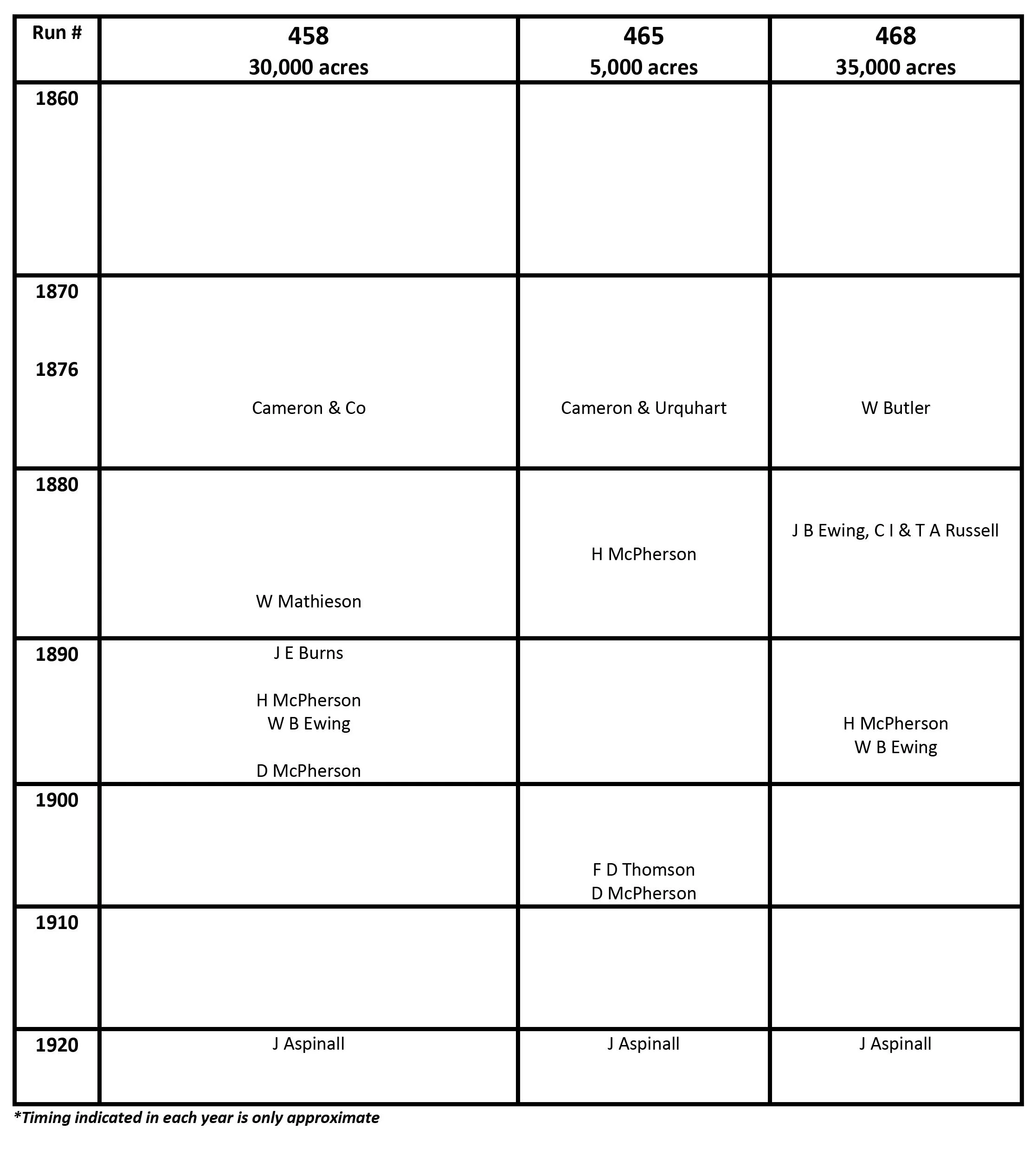
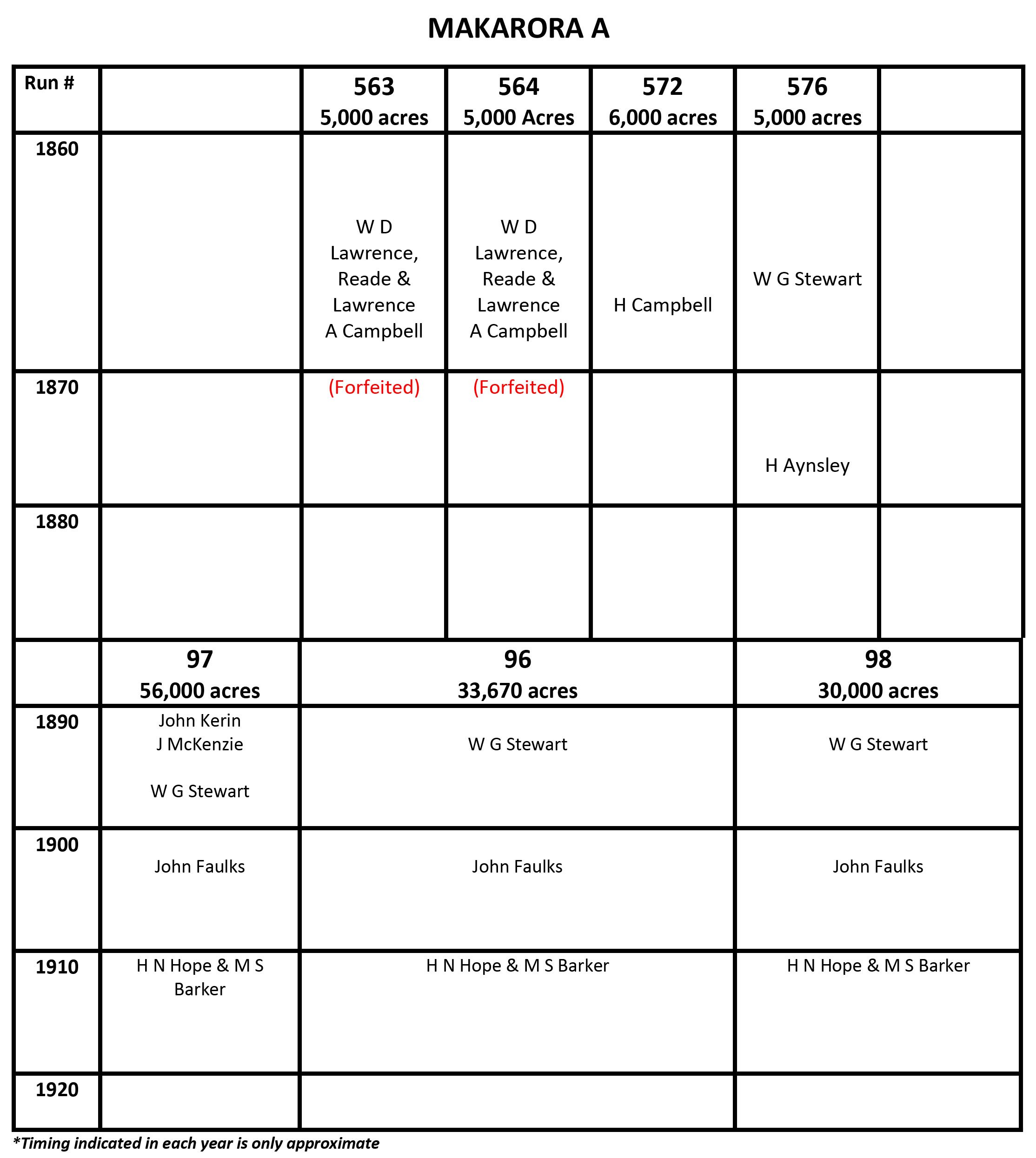
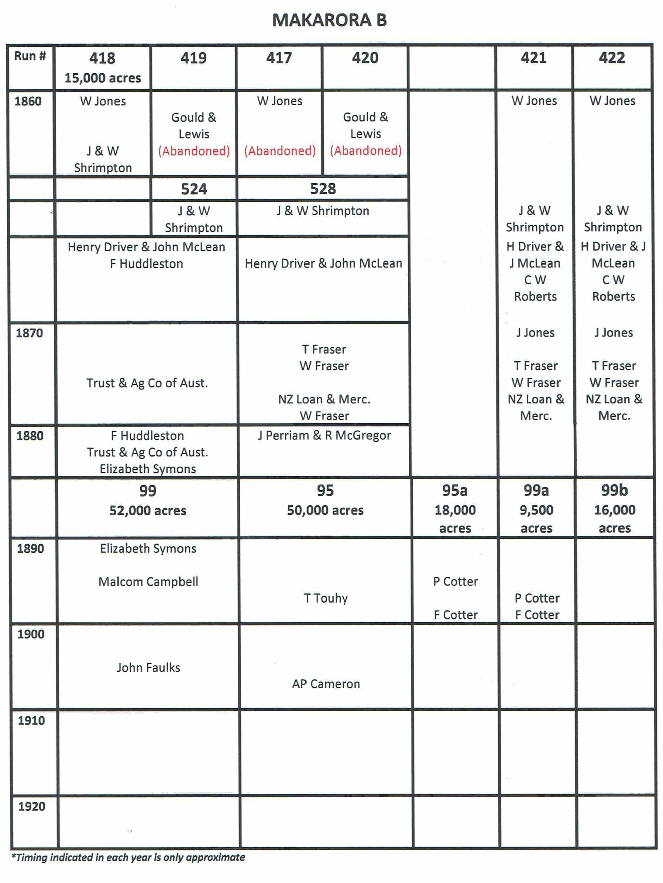
Runs Timelines
The following tables indicate the ownership of each Run and how/when some were split up into smaller Runs or merged into larger ones. The position of each name indicates the approximate time during each year that ownership changed.

