Earliest Photographs of the Upper Clutha
There are two photos of farm buildings that have been in the Upper Clutha History Society’s collection for over 30 years. One is labelled “Wilkin and Thompson’s (sic) Station, 1870s”.

Wilkin and Thomson’s Station.
The buildings are also shown on an 1865 Survey Plan by John Connell. The plan names them, from left to right, part of the shearers’ house, the men’s house, the kitchen, the house and the woolshed. The station at that time was at what is now Albert Town. The renovated “kitchen” cottage can still be seen looking across the Clutha/Mata-Au River from the D.O.C. campsite.
Robert Wilkin and his wife’s uncle, Archibald Thomson, purchased the station in 1860, subsequently adding several other pastoral leases until, by 1864, they had all the land on the west side of the Clutha/Mata-Au and Hāwea Rivers from Cromwell to Lake Wānaka and had also acquired John Roy’s Station extending around the lake to the Motatapu River, over 300,000 acres. They sold most of the station to Mathew Holmes and Henry Campbell in 1866.
The second photograph has written on the back “Cattle Flat” but it is not the Cattle Flat Station in the Matukituki Valley, and it was assumed that it was not in the Upper Clutha area. However, recently we have seen a copy of this photograph that Mark Orbell obtained from the Hocken Library in Dunedin. It is labelled as “Stewart (sic) and Kinross’s Station” and names the photographer as “Perry”.
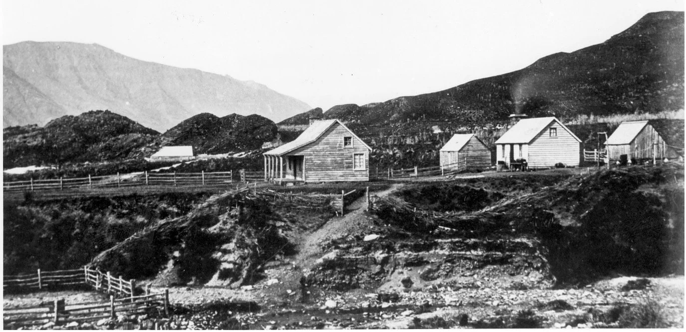
Stuart and Kinross’s Station
In 1860 James Stuart and John Kinross, both of Wellington, obtained the pastoral lease for Run 333, 100,000 acres west of Lake Wānaka from the Motatapu River to the Minaret River. Stuart and Kinross contracted George Hassing and Bill Atkins to supply the sawn timber, posts, rails and shingles for the station to be established on the lake shore at what is now known as “Colquhoun’s”, named after a later station manager. The first manager was Henry Sinclair Thomson. The station was later known as Wanaka West and in 1900 subdivided into West Wanaka and Cattle Flat stations, separated by the Matukituki River.
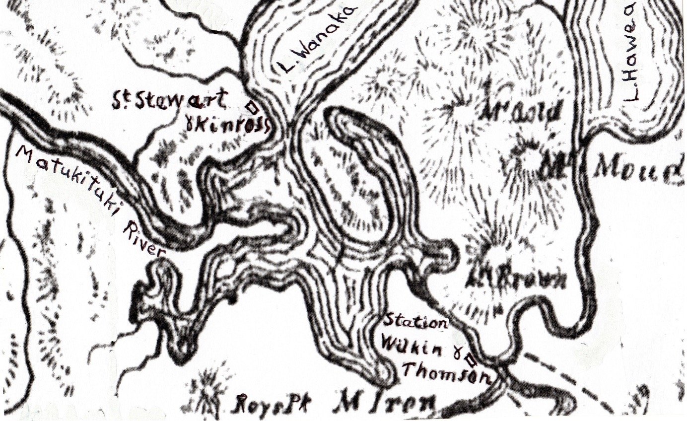
Part of Hamett and Co’s map, published in 1864.
Joseph Perry was an amateur photographer commissioned by Dr James Hector, the Otago Provincial Geologist, to take a hundred views of Otago during 1864 and 1865. Both of the station photographs were taken by Perry, as well as several others around the Upper Clutha. They are the earliest known photographs of this area.
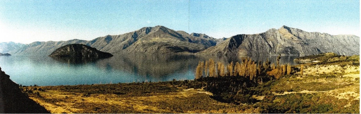
“Colquhoun’s”. The remains of the station buildings are among the poplar trees.
Photo: Ken Thomlinson, 1995